
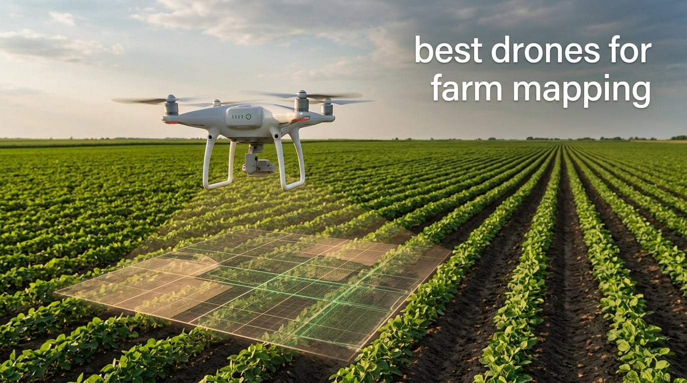
If all you want is a drone that looks good over a field, this guide is not for you. A drone for farm mapping has to do three specific jobs: fly a repeatable line over the same ground, tag every frame with accurate position data, and collect the kind of light that reveals plant stress rather than just field shape. That combination rules out most of the camera drones people buy for hobbies.
We spent a full season comparing seven airframes against what precision agriculture actually asks of them. The picks below are grouped by the job each one does well, and every one comes with a plain-English limitation so you can tell whether it fits your ground before you commit.
Two questions come up before the specs do. First, what is your acreage? A 40-acre vegetable operation and a 1,600-acre row crop farm have almost opposite answers. Second, what do you want the map to tell you? Early disease detection, irrigation scheduling, tree counts and acreage measurement each need different sensors and different accuracy, and paying for the wrong one is the most common expensive mistake in this category.
This guide was checked against the current model lineup in October 2026. Two of the ranking pages for this query still list hardware that has since been replaced, so treat anything you find there as background rather than a recommendation.
Table of Contents
Which Type of Drone Is Best for Mapping?
For most farms, a multirotor quadcopter is the best mapping drone. Fixed-wing aircraft win on acreage per day above several hundred acres, VTOL hybrids are worth the premium only when terrain stops you launching and recovering in open ground, and spray-and-map hybrids only make sense if you already run a spray rig.
Multirotor quadcopter. This is the default answer. A quadcopter can hover over a fixed point, so it captures imagery at a consistent altitude even where the ground rises into a slope. Every drone in this guide except the fixed-wing class is a multirotor, and for farms under roughly 300 acres that is the platform that keeps your workflow simple.
Fixed-wing. One battery can carry a camera over several hundred acres, which is the entire argument. The trade is deployment. A fixed-wing needs a runway or a launcher, it cannot hold position, and it cannot capture the oblique and nadir angles that make 3D orchard and terrain models. It is the right call when you are mapping open, flat ground repeatedly and your bottleneck is flying time.
VTOL hybrid. These take off vertically, transition to fixed-wing cruise, and land vertically. They solve the runway problem without giving up coverage, at the cost of a much larger airframe, a higher purchase point and more complex maintenance. For a farm wedged into hills with few clear launch areas, that solves a real problem no multirotor can.
Spray-and-map hybrid. One airframe that carries a spray tank and a mapping sensor saves buying two aircraft, but it also means carrying spray hardware on every mapping flight and living with a single point of failure. Most operations that want both end up buying a dedicated mapper and renting spraying or hiring it out per application.
Whichever platform you pick, the sensor and the positioning method decide the quality of the output. That is the part worth spending money on, and it is where the cheapest airframes in this guide fall short.
Top 3 Picks: Best Farm Mapping Drones in 2026

DJI Air 3S Fly More Combo
- 1-inch CMOS wide camera
- 3x medium tele lens
- 45-minute flight time
- Three batteries and charging hub included

Autel EVO II PRO RTK V3
- Centimeter-level RTK positioning
- PPK with no ground control points
- 1-inch 6K HDR camera
- 38-minute flight time

Autel EVO 2 PRO V3
- 1-inch CMOS sensor
- 12-bit DNG capture
- 40-minute flight time
- 360-degree obstacle avoidance
Best Drones for Farm Mapping (October 2026)
All seven airframes are listed here with the specs that actually change a mapping result. Prices move constantly, so use the buttons below each review for current figures.
| Product | Specifications | Action |
|---|---|---|
| DJI Air 3S Fly More Combo |
|
Check Latest Price |
| Autel EVO II PRO RTK V3 |
|
Check Latest Price |
| Autel EVO 2 PRO V3 |
|
Check Latest Price |
 Autel EVO II Dual 640T V3 Autel EVO II Dual 640T V3 |
|
Check Latest Price |
 DJI Mavic 4 Pro Drone with RC 2 DJI Mavic 4 Pro Drone with RC 2 |
|
Check Latest Price |
 DJI Mavic 2 Pro Enterprise Bundle DJI Mavic 2 Pro Enterprise Bundle |
|
Check Latest Price |
 DJI Matrice 4TD Quadcopter DJI Matrice 4TD Quadcopter |
|
Check Latest Price |
1. DJI Air 3S Fly More Combo – The Best All-Rounder for Field Mapping
DJI Air 3S Fly More Combo (RC 2 Screen Remote Controller), 4K Drone
1-inch CMOS wide camera
3x medium tele camera
45-minute flight time
3 batteries included
Pros
- Sharp 1-inch sensor with 14 stops of dynamic range
- Holds hover within about 2 inches in gusty conditions
- Excellent wind resistance for its size
- Fly More bundle includes three batteries and a charging hub
- Pre-programmed waypoint and point of interest modes
Cons
- No centimeter-level RTK positioning
- Battery charger sold separately
- Two memory cards effectively needed for one sortie
This is the drone we put in the hands of a grower who had never flown a mapping mission before, because it removes two things that stop most people: the learning curve and the battery anxiety. The Fly More bundle ships three intelligent flight batteries and a charging hub, so a full mapping day does not turn into a charging-stop problem.
The 1-inch CMOS primary camera with a 3x medium tele is what makes it more than a video drone. Owners regularly report holding hover within about 2 inches in gusty conditions, which matters more for orthomosaics than most spec sheets admit, because a drifting aircraft produces overlapping frames with uneven scale and a soft stitch.
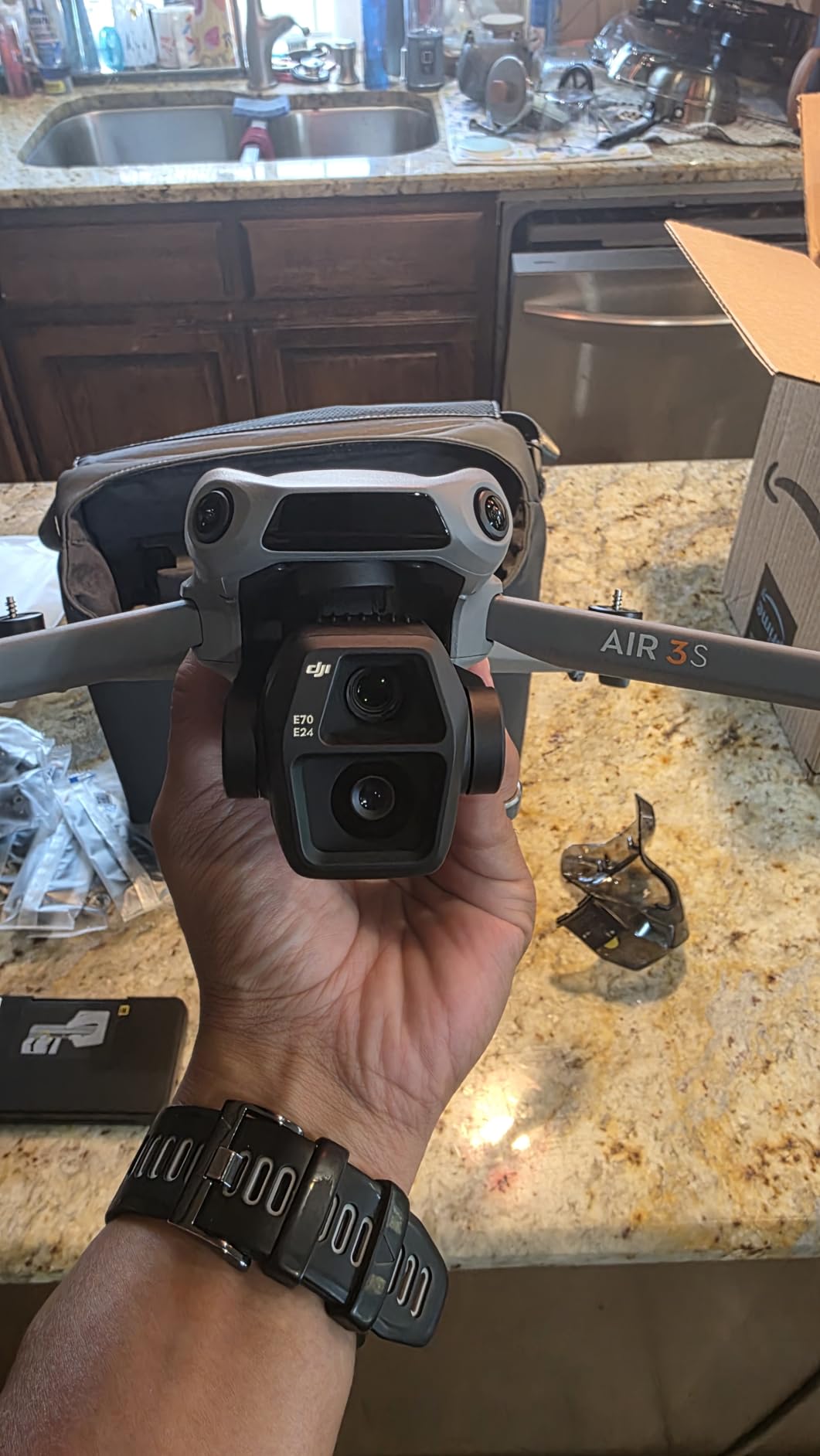
Reviewers consistently praise the wind resistance, which they attribute to the heavier airframe and larger motors. Field mapping happens in whatever weather the crop window allows, and an aircraft that grounds itself in a moderate breeze costs you days rather than minutes. The 4K/60fps HDR capture with up to 14 stops of dynamic range gives you something usable in the shaded edge of a field at midday.
There are two honest limits. There is no RTK module, so your maps will not carry centimeter-level accuracy and you will still need ground control points for survey-grade work. And the battery charger is not included, so budget for a 65W or better USB-C charger before your first flight day.
What it is genuinely good at
RGB orthomosaics, boundary and acreage measurement, plant and stand counting, and general crop scouting across fields up to a few hundred acres. This is the work most farms start with, and the Air 3S does it well without any RTK workflow to learn.
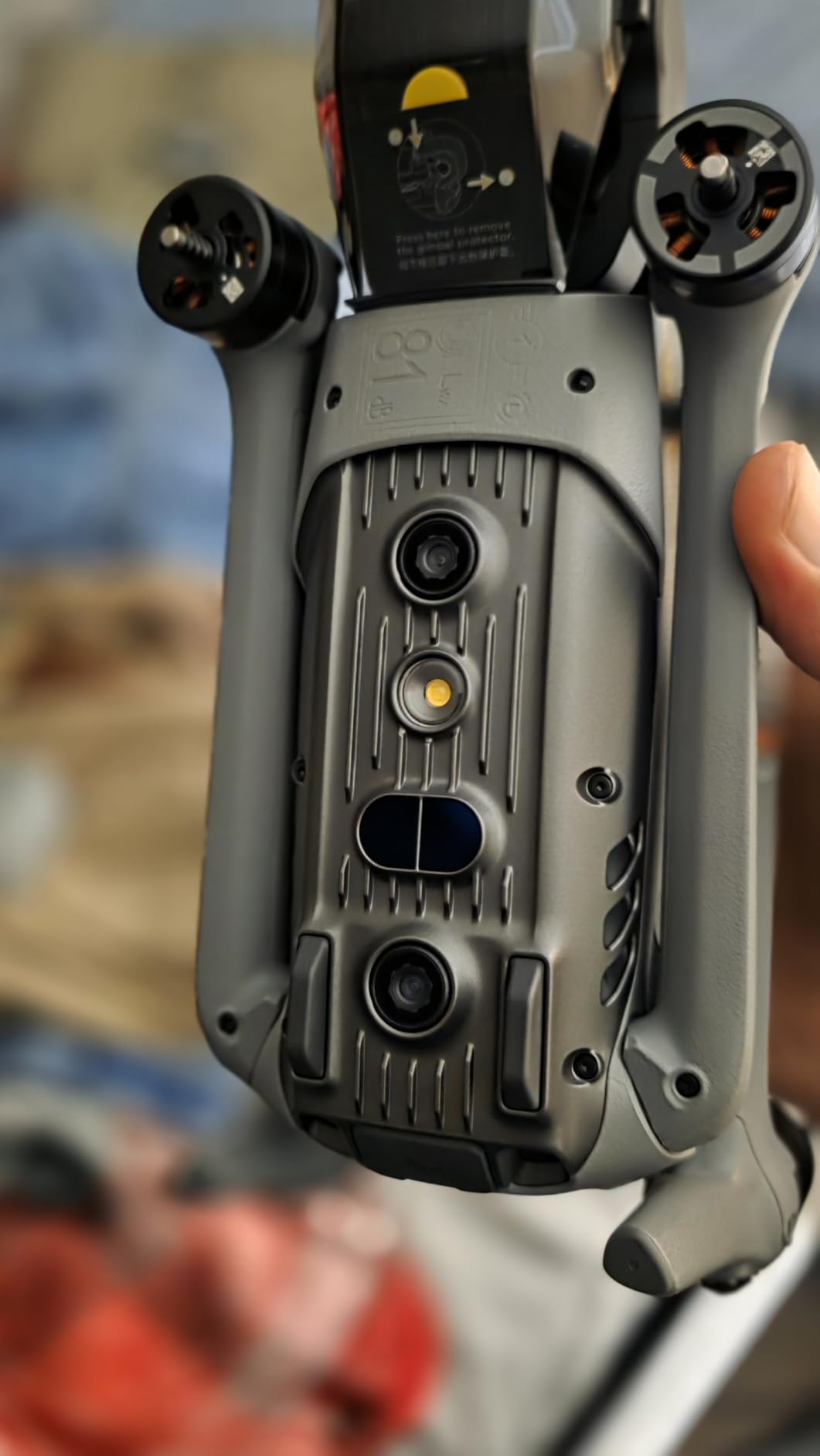
It also handles mixed operations where the same flight needs to produce mapping data and usable video, which is exactly the dual-purpose need that shows up in small-farm buying questions. The forward-facing LiDAR and night omnidirectional sensing reduce incident risk over tree lines and around livestock.
Where it falls short
It produces no NDVI or NDRE layers, so it cannot answer the question most precision agriculture programs exist to answer: which parts of this field are stressed. That requires a multispectral payload, which pushes you to one of the other models in this guide.
Sport mode also wobbles in heavy wind and the rear sensors do not protect that direction, so leave Sport mode off for field work.
2. Autel EVO II PRO RTK V3 – The Only Airframe Here With Survey-Grade Accuracy
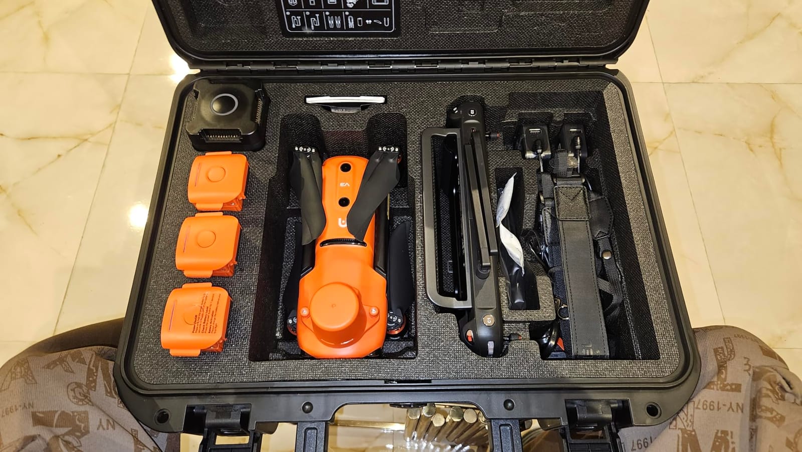
Autel Robotics EVO II PRO RTK V3 w/Real-time Centimeter-Level Positioning
RTK accuracy 1 cm plus 1 ppm
PPK with time sync, no GCPs
1-inch 6K HDR camera
38-minute flight time
Pros
- Centimeter-level RTK with base station or NTRIP support
- PPK workflow removes the need for ground control points
- Reports Pix4D orthomosaics and 3D models working well
- Very stable in strong wind
- Bright controller screen readable in sunlight
Cons
- Autel app interface is not intuitive
- Thin documentation and limited tutorials for advanced modes
- Small review base for a mapping-focused airframe
This is the airframe we recommend the moment the word survey enters the conversation. The RTK specification is 1 cm plus 1 ppm horizontal and 1.5 cm plus 1 ppm vertical, which puts every image position error down at the scale of a single crop row rather than a car width.
What makes it more useful than a plain RTK drone is the PPK support with time synchronization. Owners mapping with it report that it produces clean orthomosaics and 3D models in Pix4D, and that the repeatable flight profiles let them re-fly the same gimbal and camera positions week after week, which is the whole point when you are tracking change across a season rather than capturing a one-off.
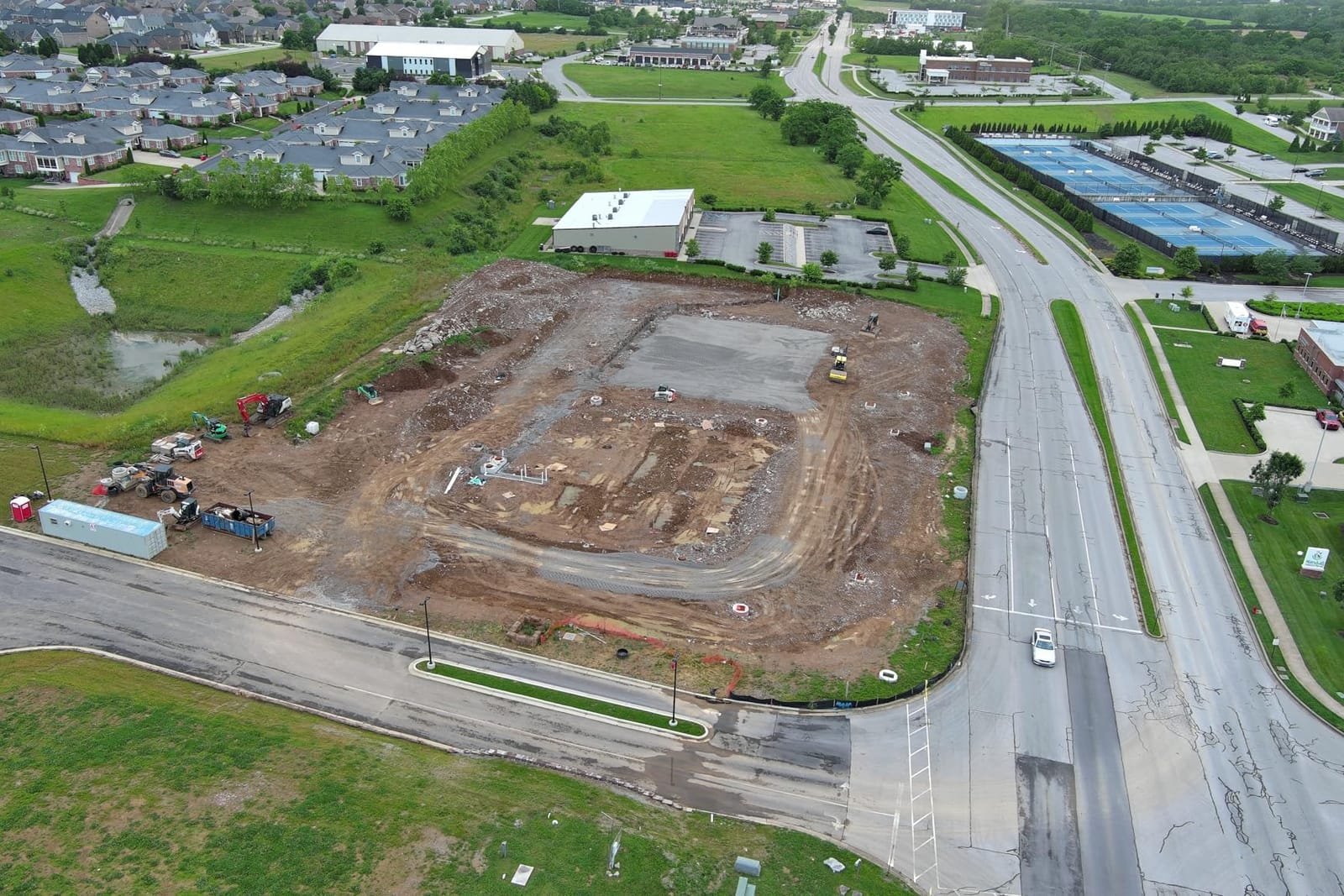
Mission types cover waypoint, rectangle, polygon and oblique photography, so you can build the nadir-plus-oblique set needed for terrain and orchard models rather than a flat map. It also supports both an RTK base station and an NTRIP network, which matters if you fly in an area with poor cellular service or no open sky for a ground station.
The 1-inch 6K/30fps HDR camera captures in a single mechanical-shutter pass rather than rolling shutter, which removes the warped geometry that makes stitched edges wobble. Flight time is 38 minutes with 15 km transmission on SkyLink 2.0, and reviewers report very stable flight in strong wind and highly accurate return-to-home.
What it is genuinely good at
Topographic and boundary surveys, drainage and elevation work, and any field where a centimeter-accurate orthomosaic has to land on an existing map or parcel line. It is also the cheapest route to getting out of the ground control point workflow entirely.
For row crops above a few hundred acres where you fly the same routes repeatedly, the repeatable profile capture plus RTK is the combination that makes season-over-season comparison actually meaningful.
Where it falls short
The software is the weak point, not the hardware. Reviewers repeatedly describe the Autel app interface and settings layout as not intuitive, with limited tutorials for the advanced features, and Autel Mapper requires a Windows machine with a capable NVIDIA GPU.
It is also a visible-light airframe. There is no multispectral or thermal payload on this model, so it will give you an accurate picture of your field without telling you what is wrong with the plants in it.
3. Autel EVO 2 PRO V3 – Best Value for Imaging-Heavy Field Work
Autel Robotics EVO 2 PRO V3, 1″ CMOS &12-Bit Image 6K HDR Video, ISO 44000
1-inch CMOS with 6K capture
12-bit DNG RAW
40-minute flight time
SkyLink 2.0 to 15 km
Pros
- Excellent low-light and dynamic-range image quality
- 12-bit DNG RAW gives strong post-processing headroom
- Accurate return-to-home and precision landing
- 40-minute flight time
- No geo-fencing compared with some platforms
Cons
- Waypoint missions lack spline flight paths
- Rectangle and polygon missions restrict RAW and video capture
- Gimbal roll or drift reported by some owners needing calibration
Across 247 reviews on record, the most common theme is image quality rather than flight performance. The 1-inch CMOS sensor with an adjustable F/2.8 to F/11 aperture and 12-bit DNG capture gives you real headroom in post, which is what separates a usable mapping frame from a screenshot.
Flight time is 40 minutes and wind resistance is rated to 27 mph, with 360-degree obstacle avoidance from 12 visual sensors plus 2 sonar units. SkyLink 2.0 transmission runs to 15 km on tri-band 2.4, 5.8 and 900 MHz. The included 6.4-inch OLED Smart Controller SE is bright enough to read in direct sun at the field edge.
One detail matters more than it sounds for farm work: this airframe has no geo-fencing compared with some competing platforms. If you work across a property where coordinates are awkward, or a neighbouring runway sits close to your boundary, that alone can save you a season of frustration.
Owners put it through real-estate and photogrammetry work, and the pattern in the reviews is that the camera does the heavy lifting. Detailed camera settings and gimbal control options let you set exposure manually across a field instead of trusting an auto algorithm that reacts to cloud shadow.
What it is genuinely good at
High-quality RGB orthomosaics and 3D reconstruction where ground sampling distance matters, plus reliable video for agronomy demonstrations, client updates and marketing. It is a strong companion to a camera drone comparison if you also shoot farm content commercially.
For operations under roughly 150 acres that want professional imagery without the survey-grade price, it is the sensible middle. You can run waypoint missions, capture rectangles and polygons, and get home with battery to spare on a 40-minute pack.
Where it falls short
The mission planner has real limits. Waypoint missions lack spline flight paths because of the PX4 platform underneath, and rectangle or polygon missions restrict RAW capture and video recording, so you get a simpler flight plan than the RTK model offers.
There is no centimeter-level positioning built in, and some owners reported gimbal roll or drift that needed recalibration. Budget time for a pre-flight calibration ritual.
4. Autel EVO II Dual 640T V3 – Thermal and Irrigation Work in One Airframe
Autel Robotics EVO II Dual 640T V3, 640×512 Thermal Imaging Drone, RemoteID
640x512 thermal at 30 fps
50MP 8K visible camera
D-RI ranges
38-minute flight time
Pros
- Thermal performs well including at night
- Picture-in-picture overlay locates problems in the visible frame
- Strong build with stable steady flight
- Accurate collision avoidance and landing precision
- Good customer service and warranty replacement reported
Cons
- Does not accept Autel payload attachments
- One report of the thermal camera failing within a year
- Camera cover on the case is a weak point
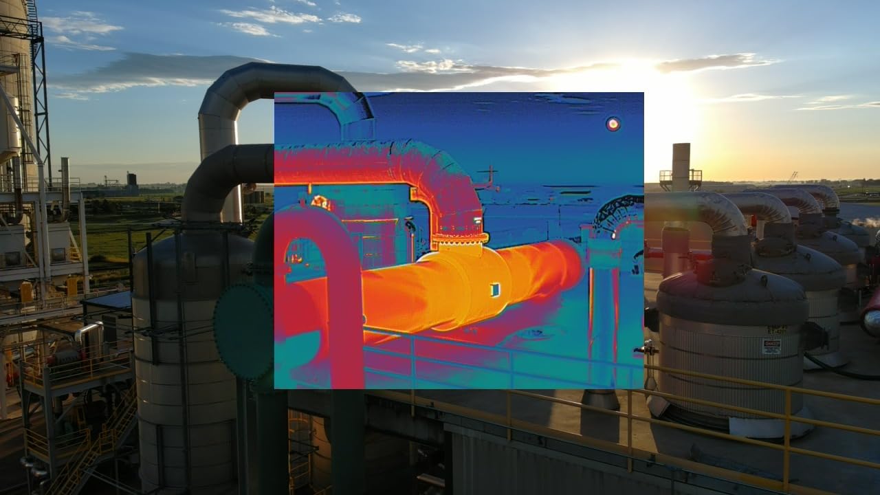
Thermal is the sensor people forget until they need it. It is what finds the failing irrigation emitter that is drowning a patch of stand, the animal down in a draw, the moisture problem under a canopy that never shows in an RGB image. The 640×512 thermal sensor runs at 30 fps with a standard 13mm lens and 16x digital zoom.
The visible side is not an afterthought. A 0.8-inch CMOS RYYB sensor captures 50MP at 8K with 4x lossless and 16x digital zoom, so you get a conventional photo record and a heat record from the same flight, which is what makes tracing a heat anomaly back to a field location possible.
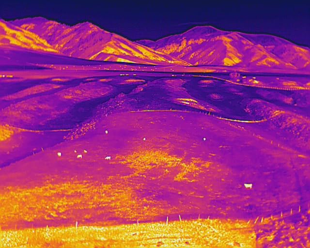
Thermal subject recognition reaches up to 100 m, and the D-RI detection, recognition and identification ranges give you a defensible number for whatever you are inspecting rather than a vague hot spot. There are 10 or more thermal palettes and more than 10 temperature measurement modes, including spot, central and regional readings, plus picture-in-picture, isotherm and temperature alarm.
Build quality comes in for praise. Owners report strong construction, steady flight, accurate collision avoidance, and landing within a couple of feet of the target. Return-to-home is described as reliable, and at 38 minutes per battery with 15 km SkyLink 2.0 transmission you have time to survey and then investigate.
What it is genuinely good at
Irrigation management, livestock monitoring, and night or low-light scouting where sunlight is not an option. The 19 sensor groups including 12 visual sensors support real-time 3D map building and path planning, so it can build a route around obstacles rather than refusing the job.
It is also Remote ID compliant, which matters if you are mapping under the current US rules.
Where it falls short
It does not accept Autel payload attachments. Only the Enterprise series does, so you cannot bolt a multispectral or RTK module onto this airframe later, which caps how far it can grow with your operation.
Thermal resolution of 640×512 is modest next to dedicated radiometric sensors, and one reviewer reported a thermal camera failure within a year. The case camera cover is also called out as a weak point that can crack.
5. DJI Mavic 4 Pro – The Detail and Video Specialist
DJI Mavic 4 Pro Drone With DJI RC 2, Flagship Tri-Camera Drone
100MP 4/3 CMOS Hasselblad camera
Dual tele camera array
51-minute flight time
Pros
- 100MP sensor produces standout photo and video quality
- Very stable in wind and holds position well
- Long battery endurance suits longer survey sorties
- Dense sensor suite gives strong crash avoidance
- Fast reliable image transfer
Cons
- Gimbal described as fragile and expensive to repair
- Obstacle sensing can be overly sensitive in confined spaces
- DJI Care service plans not offered in the US
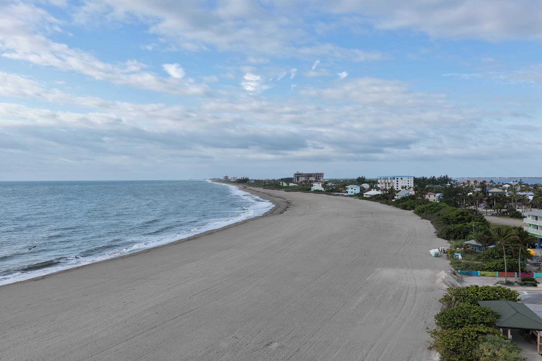
The 100MP 4/3 CMOS Hasselblad main camera is the largest sensor in this guide and it shows. At 51 minutes maximum flight time with O4+ transmission out to 30 km and a 10-bit HDR feed, it also has the longest endurance on paper, which translates directly into more hectares before a battery swap.
Two additional tele cameras on 1/1.3-inch and 1/1.5-inch CMOS sensors give you a genuine zoom option. That is the reason to pick this one for orchards and vineyards: from legal altitude you can inspect a single vine or a tree canopy without flying dangerously low.
Flight characteristics are strong. Reviewers describe it as very stable in wind, holding position well, with 0.1-lux Nightscape omnidirectional obstacle sensing and a 360-degree rotating Infinity Gimbal. Forward-facing night LiDAR rounds out the safety suite for working around tree rows and farm structures.
The weight is 2,372 g with a 6,654 mAh battery, and the RC 2 controller carries a 7-inch rotatable high-brightness display, which matters when you are reading a route on a sunlit field edge rather than under a desk.
What it is genuinely good at
Orchard and vineyard row mapping, tree counting, canopy condition assessment and any job where you need both a data record and presentation-quality video from the same flight. Long endurance also makes it a good fit for grazing land monitoring across large paddocks.
If your operation also produces video for agronomy clients or marketing, this is the one in the guide that does both without a compromise. Our professional camera drone roundup has more options if media output is the priority.
Where it falls short
It is heavier and more expensive to service than the smaller airframes, and the dominant negative theme in reviews is US after-sales. DJI Care service plans are not offered in the US, which raises repair cost risk, and the gimbal is described as fragile.
There is still no centimeter-level RTK in this configuration, and obstacle sensing can be overly sensitive in confined spaces such as a dense orchard row.
6. DJI Mavic 2 Pro Enterprise Bundle – Low-Cost Way Into Mapping Work
DJI Mavic 2 Pro Enterprise Bundle
Hasselblad L1D-20c 20MP sensor
Mechanical shutter
31-minute flight time
907g takeoff weight
Pros
- Mechanical shutter removes rolling-shutter distortion in stitched maps
- Carbon fibre airframe with omnidirectional obstacle sensing
- Bundled accessory kit with memory card and USB reader
- Small and light at 907g takeoff weight
Cons
- Older generation with shorter flight time than current models
- Bundle assembled by a third-party seller
- Very small review base limits independent feedback
The single most important spec on this older airframe is the mechanical shutter. Rolling-shutter distortion is the quiet reason some stitched maps wobble at the edges, and a mechanical shutter on the Hasselblad L1D-20c 20MP 1-inch CMOS sensor removes it entirely for a modest outlay.
At 907g takeoff weight with a 3-axis gimbal and up to 31 minutes of flight time, it is a low-cost way to capture a clean geometric image set. Eight gigabytes of internal storage plus SD expansion to 128 GB means a smaller field fits without a mid-flight card swap.
Note that this listing is a bundle assembled by a third-party seller rather than straight from the manufacturer. The bundle adds a PGYTECH accessory package, a 32 GB microSD card and a USB reader, which is convenient, but it also means warranty and support run through that seller.
ActiveTrack 2.0, omnidirectional obstacle sensing and adjustable aperture round out a package that is genuinely useful for inspection and light survey work on a smaller acreage.
What it is genuinely good at
Getting a first orthomosaic off the ground without a large commitment. If your operation is under 100 acres and you want to see whether drone data changes anything before you invest in an RTK airframe, this is an affordable route to a real result.
It is also a reasonable backup aircraft. Small farms often end up flying one drone for mapping and another for general work, and a light carbon-fibre airframe like this is easy to carry to a field two hours away.
Where it falls short
It is an older generation design. Thirty-one minutes is short next to 45 and 51 minutes elsewhere in this guide, so your acres per day will be meaningfully lower and the battery count required goes up.
There is no RTK, no multispectral and no thermal. Independent feedback is also thin because the review base is small, so you are buying on reputation rather than on volume of owner reports.
7. DJI Matrice 4TD – Thermal, Laser Range Finder and IP55 in an Enterprise Frame
DJI Matrice 4TD Quadcopter with RC Plus 2 Enterprise, Thermal, Wide & Tele Lenses, Laser Range Finder, Low-Noise Anti-Ice Propellers, IP55
Triple-lens array plus high-res thermal
Built-in laser range finder
IP55 weatherproofing
Pros
- Thermal sensor with strong zoom for distant targets
- Exceptionally smooth stable flight and camera motion
- Laser range finder gives accurate target distance
- Weather-resistant build supports poor field conditions
- RC Plus 2 Enterprise controller included
Cons
- DJI Care not available in the US so service comes from third parties
- Very small review base limits long-term reliability data
- Auxiliary lighting accessories can interfere with obstacle detection
This is the only airframe in the guide rated IP55, and that single spec changes when you can fly. Water and dust resistance plus low-noise anti-ice propellers mean you can work in rain, dust and near-freezing conditions instead of losing the day to weather.
The sensor stack is unusual for a drone this size: a triple-lens visual array, a high-resolution thermal sensor with near-infrared illumination, and a built-in laser range finder that gives you distance and coordinates to a pinpoint target. Owners highlight the thermal zoom as useful for inspecting distant assets, and both available reviews rate the aircraft 5 stars.
What it is genuinely good at
Utilities, solar arrays, infrastructure inspection and large-scale operations that map in bad weather. Operators report roughly 35 minutes per battery in windy conditions, and at a 10-pound weight it carries a real payload class of sensor.
For government and institutional buyers it integrates with DJI Dock 3 and FlightHub 2 for automated fleet programs, which is the part that lets a mapping program scale past one operator. The RC Plus 2 Enterprise smart controller is included.
Where it falls short
There are only two customer reviews on record, so you have almost no independent long-term reliability data for an airframe at this price point. That is a real gap and worth weighing against the RTK model, which has a longer owner history.
DJI Care is not available in the US, so service plans have to come from third parties. Auxiliary lighting accessories for night work can also interfere with front and side obstacle detection, so test any lighting rig before mapping around obstacles.
How to Choose a Mapping Drone for Your Farm
Spec sheets bury the decisions that matter. Here are the five questions worth answering before you spend anything, in the order they should shape your shortlist.
RTK, PPK or plain GPS: what each one actually fixes
Plain GPS on a consumer drone puts image positions within a couple of metres, which drifts visibly in an orthomosaic and makes two surveys of the same field impossible to compare. RTK corrects positions in real time against a base station or NTRIP network, and PPK records raw data for correction in post. Both reach centimeter-level accuracy; PPK is more forgiving of a dropped correction link, RTK is simpler in the field.
With either one, ground control points become optional for mapping. Without either, they are mandatory. If your operation needs to measure area, set out a drain line or produce a survey-grade surface model, RTK or PPK is not optional.
Multispectral, RGB or thermal: matching the sensor to the job
RGB gives you shape, boundaries, stand counts and imagery. It cannot see plant stress, which is a change in spectral reflectance rather than a visual difference. Multispectral adds separate red, green, blue, red edge and near-infrared bands, which is what NDVI and NDRE are calculated from, and it is the only way to build a variable rate prescription you can act on.
Thermal sees heat, so it finds irrigation failures, livestock and night activity. None of the three substitutes for another, and no airframe in this guide carries multispectral, which is worth knowing before you commit to one.
Ground sampling distance decides what you can actually see
Ground sampling distance is how many centimetres one pixel covers on the ground. A coarse figure gives you a beautiful map of a field and nothing else. Fine figures let you see individual plants, which is where disease detection, plant count and weed mapping become possible.
The practical rule: the higher the sensor resolution and the lower you fly, the finer your ground sampling distance. This is why a 100MP sensor is genuinely useful here rather than just a larger file.
Ground control points: when you still need them
If you have RTK or PPK and the base station or network coverage held for the whole flight, you can usually skip GCPs. Without them, or when you have an RTK fix loss mid-field, you survey targets whose coordinates you know and the software corrects against them.
Plan for a half-day of GCP work and its travel time if you buy a non-RTK aircraft on a large property. That hidden labour cost is often larger than the gap between a basic RTK model and an advanced one.
Which tier of hardware fits which farm
Under 100 acres, a good RGB multirotor is enough to prove the workflow. Between 100 and 500 acres, RTK or PPK becomes worth it because labour time per flight stops dominating. Above that, fixed-wing coverage starts to matter more than sensor sophistication, unless your crop is trees.
Orchards, vineyards and grazing land reward tele lenses and thermal regardless of acreage. Row crops reward multispectral. Match the sensor to the crop before matching the sensor to the acreage.
Acres per Flight: Planning a Real Mapping Day
Buyers in the drone mapping community keep asking one operational question: how much ground can one aircraft actually cover in a day. The answer depends on three numbers you can read off a spec sheet, and on weather you cannot control.
Start with flight time, which ranges from 31 minutes on the oldest bundle in this guide to 51 minutes on the Mavic 4 Pro. Then subtract a reserve. You want roughly 20 percent of the pack left for the return leg, the climb-out, a repositioning move and a landing margin. What remains is your productive mapping time.
Next, fix your flight altitude, because coverage scales with the square of it. Flying at half the height quarters the area per line. Then account for overlap: a solid orthomosaic normally flies with roughly 70 to 80 percent forward overlap and 65 to 75 percent side overlap, and that overlap is the real reason a survey flight covers far less ground than the flight time suggests.
Multiply lines by line length for area per battery, then multiply by flights per day, which is battery count multiplied by batteries you can turn around between flights. A three-battery bundle genuinely changes the daily number, which is why the Air 3S bundle is the one we recommend for a first season.
Finally, subtract the non-flying work. Flying a field is a small part of mapping it. You still have to charge, walk boundaries, move between paddocks, check that the imagery actually covers what you needed, and process it. Budget a full day for roughly a day and a half of flying, and plan campaigns for periods with stable weather rather than a fixed date.
Repeatability is the part that matters most across a season. A thread on the drone mapping side of the community described a grower building a rig for mapping 100 acres daily, and the real question behind it is not camera quality but whether the same route can be flown again and produce a comparable data set. Save your mission file, your altitude and your overlap settings, and treat them as part of the aircraft.
FAA Part 107, Remote ID and Buying for Government Work
Any commercial mapping flight in the US needs a Part 107 remote pilot certificate and aircraft registration. That part is settled. The parts that trip up buyers are Remote ID, line-of-sight rules and procurement compliance.
Remote ID is the broadcast requirement, and support is worth checking before purchase. Two airframes in this guide are explicitly listed with Remote ID support, so you can confirm compatibility from the product page rather than assuming it.
Beyond visual line of sight is the harder one. A farmer mapping their own field from the edge of that field is straightforward. A contractor flying a 1,200-acre block at a 400-foot ceiling is a different problem, because automated or extended operations need specific authorization, and rural connectivity issues mean relying on cloud-based command links is not always practical.
If you are buying for a government contract or a utility, ask specifically whether the aircraft is on the Blue Dot list and whether the supply chain is NDAA-compliant. That requirement narrows your options sharply, and it is better to know before you buy than after a procurement review. Also confirm what the manufacturer offers for service in your country, since an airframe with no official service plan carries more downtime risk than its spec sheet suggests.
Frequently Asked Questions
Which type of drone is best for mapping?
For most farms, a multirotor quadcopter is the best mapping drone. It hovers over a fixed point, so imagery stays at a consistent altitude over sloping ground, and it deploys from a field edge without a runway. Fixed-wing aircraft cover more acres per day and win above several hundred acres of open flat ground, while VTOL hybrids are worth considering only where terrain prevents launching or recovering in the open.
What is the best drone for mapping and surveying?
The Autel EVO II PRO RTK V3 is the strongest surveying airframe here, delivering 1 cm plus 1 ppm horizontal RTK accuracy with PPK support that removes the need for ground control points, a 1-inch 6K mechanical-shutter camera and 38 minutes of flight time. For general field mapping without survey-grade accuracy, the DJI Air 3S offers the best combination of image quality, endurance and bundled batteries.
What is a good budget drone for mapping?
The DJI Mavic 2 Pro Enterprise Bundle is the lowest-cost way to produce a clean orthomosaic, because its mechanical shutter removes rolling-shutter distortion that spoils stitched maps. For most small operations the DJI Air 3S is the better budget choice, since its three-battery bundle removes charging downtime and its 1-inch sensor holds up in real field light.
Do I need RTK for farm mapping?
RTK or PPK is needed if you want centimeter-level accuracy, need to compare surveys flown weeks apart, or must overlay your data on an existing map or parcel boundary. Without it, image positions drift by a couple of metres and ground control points become mandatory. For early scouting and acreage measurement on a single pass, plain GPS is workable.
How many acres can a drone map per day?
It depends on flight time after reserve, flight altitude and image overlap. Airframes here run 31 to 51 minutes, and flying with 70 to 80 percent overlap means a battery covers far less ground than the flight time implies. A three-battery bundle such as the Air 3S typically lets you work a full field block in one session, but allow a day and a half of total time for the flying and the ground work.
Can I use a regular drone for crop health monitoring?
Partially. An RGB drone such as the Air 3S or the Mavic 4 Pro will show boundaries, stand counts, irrigation problems visible to the eye and general crop condition, but it cannot produce NDVI or NDRE because it does not capture red edge or near-infrared bands. Real plant stress detection needs a multispectral sensor, and none of the airframes in this guide carries one.
Which Farm Mapping Drone Should You Buy?
Start with acreage and crop. Under 100 acres, buy the DJI Air 3S Fly More Combo and confirm that RGB scouting is enough for what you are trying to learn. Between 100 and 500 acres, or anywhere accuracy matters, buy the Autel EVO II PRO RTK V3 and plan your GCP strategy before the first flight.
Match the sensor to the problem instead of the price. Orchards, vineyards and grazing land want the Mavic 4 Pro tele array or the Autel EVO II Dual 640T for thermal. Irrigation problems need thermal. Accurate parcel and elevation work needs RTK or PPK. And if your real goal is NDVI-driven variable rate prescriptions, plan on a multispectral payload, because none of these seven carry one natively.
Whichever you choose, fly the same route on every visit and keep the overlap settings identical. Repeatable data across a season is worth more than any single perfect flight, and that is the habit that turns a mapping drone into a decision tool rather than an expensive hobby.
Our related drone guides cover the imaging side in more depth if you are weighing mapping hardware against professional camera drones, obstacle avoidance systems, or general camera drone picks for the seasons when the job is not a survey at all.